
Introduction
You may know by now that due to the Antarctic Treaty, all military activity below 60° latitude is strictly prohibited, but the continent still has a history. Antarctica is the only continent on Earth that is considered to have never seen war (although there have been instances of hostility, no conflict has ever lead to loss of life below 60° latitude). While this is mostly due to it's inhospitable nature and recent discovery, today's continued arms control over a piece of land that has the potential to be an immensely valuable weapons testing and development location takes continued effort and commitment to team work from all world powers.
Past military debates have also been a pivotal factor in the decision to indefinitely suspend territorial claims, and has had a large (but often overlooked) impact on the current protection of the continent.
Early Exploration and Strategic Interest
In the 1800s, multiple countries scrabbled over the newly discovered land, especially due to lucrative whaling and sealing prospects. However even as competitive as they were, these standoffs rarely escalated beyond the warning of raising their flags.
The Falkland Islands, being one of the most hospitable regions near (but not in) Antarctica with it's lightly warmer climate, has been a sore point that has been argued over for over 200 years. Military involvement in this multi-nation feud started in 1832, when the USS Lexington raided the islands that were at that time claimed by Argentina. They also stripped the island of its working governing body, taking a number of persons of importance as prisoners under the justification of 'piracy'.
During the mid-19th century, military activity briefly died down in step with the decline in whaling activity, but returned even stronger when new technology and uses made whale oil skyrocket in demand. Much of the whaling and sealing was kept to lower latitudes due to more infrequency of sea ice, and also due to the fact that at this time much of the continent was still an unmapped mystery.
Expeditions to the continent during this time were often claimed to be for scientific purposes, but also undoubtedly served the purpose of attempting to lay claim to land. Their promises to map the continent were largely driven by the fact that maps were needed to make legal claims. A few countries did deploy armed navy ships for this purpose, but none were willing to start wars over these disputes.
Military Activities during WWI and WWII
There was a brief hostile encounter between the Germans and British that took place at the Falkland Islands during WWI, however the Falkland Islands do not lie below 60° latitude, and are not considered part of Antarctica (they are in the subantarctic region), so the interaction is not considered Antarctic conflict. The same is true for the Falklands War of 1982.
While most countries were otherwise preoccupied during the first few years of the 20th century with WWI, in their free time shortly following Britain internally proposed a plan to 'annex' the entire continent of Antarctica. They had already self-claimed sovereignty over nearly the entire Antarctic peninsula and a number of sub-antarctic islands. The proposal was never acted on, out of concern that such a forward move could mean risking the loss of its US and French allies. There was also reasonable concern that Chile and Argentina would retaliate.
When Britain was again preoccupied with WWII in the early 1940s, Argentina took the opportunity to land on Deception island and seize an abandoned station in 1942. They planted their own flag, as well as painting it on the sides of previously standing buildings. After facing no immediate opposition, Argentina then proceeded to do the same with all antarctic territory below a latitude of 60°S, and between 25°W and 68.34°W over the course of the same year. Although not recognized by any other countries, they claimed the secured land had been annexed and they owned it.

The following year, in 1943, Argentina set out the ship "Primero de Mayo" to claim more land, however this time Britain responded with force, having discovered what Argentina had done to their bases the previous year. They sent an armoured ship, HMS Carnarvon Castle, which first returned to Deception island to repaint their own flag (the Union Jack) over that of Argentina's. They then moved on to do the same with Argentina's claimed Laurie and South Orkney Islands.
At the same time, Argentina returned to Britain's reclaimed islands and again repainted their own flags. When HMS Carnarvon Castle was confronted by another Argentinian ship in the area, they claimed they were simply patrolling to ensure the Germans had not found a home in any of their old stations.

This feud continued for nearly a decade, with Argentina deploying eight warships to protect their established bases in 1948. In 1952, Britain returned to Hope Island to rebuild a deserted base, but discovered Argentina had built a new base, 400 metres away. The Argentinians fired on the British with machine guns to show force, to which the British retreated, only to return a few days later with a high military commander presiding from the Falkland Islands, and the Royal Marines.
The Argentinians consequentially withdrew, and the British once again established their base. Argentina later apologized, claiming the commander overstepped his authority.
The USA, involved in their own Antarctic military operations at the time, signed the Inter-American Treaty of Reciprocal Assistance (also known as the 'Rio Treaty') with 20 other Central and South American countries in 1947. This treaty, likely a result of many countries feeling insecure and potentially threatened by European nations following WWII, stated that any attack from a country external to the agreement would be treated as an attack against all, and would be responded to as such.
America convinced other parties to add the area between 24° West to 90° West to the self-named 'American Quadrant' within the treaty. Although not the main focus, this extended to a portion of Antarctica, including the Antarctic Peninsula and some of Queen Maude Land, meaning it would be protected under the treaty as well.
In response to America's very forward move, that same year Chile's military coordinated a Chilean Antarctic expedition to re-assert the claims they had already made. Other countries mounted similar expeditions that were claimed to be (and mostly were) for research purposes, however reinforcing bases and gaining familiarity of the region also served a second purpose of strengthening their claims to the land if ever challenged in the future. For example, France led an expedition two years later from 1949-1950, and another collaborative expedition followed between Norway, Britain, and Sweden shortly after.

Other brief engagements went on throughout the following years, particularly between Argentina and Britain, but eventually both sides recognized that the back and forth would get them nowhere.
Tired of fighting and to ensure security of the land they had claimed, in 1949 Argentina, Britain, and Chile finally decided to make an official agreement not to station any military vessels south of 60° latitude.
Despite Britain later violating the agreement by sending vessels to both Deception Island and Hope Bay, the agreement was maintained on paper until 1961, when the creation of the Antarctic treaty made it an international law.
Military Operations
Over the years, but particularly in the mid-20th century before the passing of the Antarctic Treaty, different countries did run their own various versions of military operations. Of these, the most notable are Operation Tabarin by Britain, multiple American operations, and the German Antarctic Expedition of 1938.
Operation Tabarin (Britain, 1943-45)
This program was launched as a very covert mission during WWII, motivated largely by logistics of the war for a few key reasons. While an important purpose of the mission was to gain a stronger hold on the security of the Falkland Islands, the operation also aimed to ensure that enemy vessels could not hide or find refuge in the protected coves and passages of the continent. This concern stemmed from the fact that enemy ships had been known to travel as far as Uruguay and Argentina, and the German Expedition in 1938 had demonstrated Germany to be serious about engaging with Antarctic territory. On top of this, British and allied supply ships were being attacked by U-boats even in far corners of the world, and Japan was gaining momentum across Asia. The possibility of leaving the region unguarded to enemy forces was too great of a risk to take.
For all of these reasons, Operation Tabarin sought to establish multiple bases on the Antarctic Peninsula, but Britain did not miss the opportunity to conduct science as well.
The expedition left Britain with a crew of 14 aboard repurposed ship HMS Bransfield, and was led by a former member of Sir Ernest Shackleton's expedition of 1921-22, James Marr. After being forced to return briefly to the Falkland Islands to exchange the poorly performing HMS Bransfield for a ship more suitable to the harsh environment (HMS William Scoresby), they stopped first at Deception Island to once again reestablish their presence with 'Base B' of the operation. They left five members of the expedition to set up here, and moved on to the Gerlache Straight. Goudier Island was not the planned location for 'Base A' (it was intended to be built on Hope Island), but various factors including impending weather and lessening fuel, meant they had limited options. This is where the historic Port Lockroy base was established.

The bases were initially classified, but nearing the end of the war in 1944 were publicly announced. A further base (and unmanned 'Base E') was proposed, but this plan was ultimately discarded in favor of building 'Base D' on Hope Island. Today, Port Lockroy has been converted into a museum for Antarctic tourists. The reestablished base on Deception Island 'Base B', was destroyed in the sixties due to damage from eruptions on the volcanic island. Although Deception Island has not erupted since 1970, the island itself is an inverted active volcano (meaning boats can travel directly into the center of the volcano), so tourism boats still watch for volcanic activity before landing.
Operation High Jump & Operation Windmill (USA, 1946-48)
Taking place shortly following WWII, Operation High Jump was the largest military operation attempted on the continent at the time. The group that was put together, US Naval Task Force 68, included 4700 personnel, over a dozen ships, an aircraft carrier, and over 30 aircraft. Influenced by the looming Cold War between the USA and Russia, America felt they needed to impose a large military force, and decided the Antarctic would make a great training ground for the force. Going over the North Pole was considered the best and fastest attack against Russia due to it's short distance to dense and critical areas. They could train pilots, naval officers, and engineers to work in harsh polar conditions of Antarctica, and justify it as an expedition.
Led by Richard Byrd, the operation established the base 'Little America IV' on the Ross Ice Shelf, and also conducted a multitude of scientific experiments, contributing over 70, 000 aerial images to the mapping of the continent and thousands of hours of video from over sixty flights. By conducting endless tests and experiments, the US Navy was able to discover the ideal equipment, technology, radio gear, medical treatments, food storage techniques, forms of transportation, cooking approaches, and survival practices for polar operations.The following year, the US returned with Operation Windmill, led by Gerald Ketchum. The main goal of this subsequent operation was to be able to accurately use the images for mapping by referencing landmarks and topography of the land, as well as continuing other experiments and training.
Operation Argus (USA, 1958)
Operation Argus was not necessarily an Antarctic operation, however it did take place only around 3000 kilometres from the continent, and is important to understanding how the unsanctioned testing of any nuclear weapons in Antarctica would inevitably be discovered by other nations and researchers.
This mission consisted of a number of nuclear test detonations, over the course of a few months, to determine whether nuclear explosions interacted with correspondence and munitions systems. It was determined that the detonations did indeed interfere with technology. The weapons were set off over the south Atlantic Ocean, but radioactive fallout from the tests (although weak) traveled all the way to ice sheets in the Antarctic coast, where they settled and were preserved in the ice.
In fact, Antarctic ice samples hold evidence of radioactive fallout from many nuclear tests of the fifties and sixties, in chronological order, even from thousands of kilometres away. This, in addition to today's is intense satellite mapping, abundance of international bases, and frequent multi-purpose fly-overs, makes it next to impossible to hide any illegal military activity on the continent.
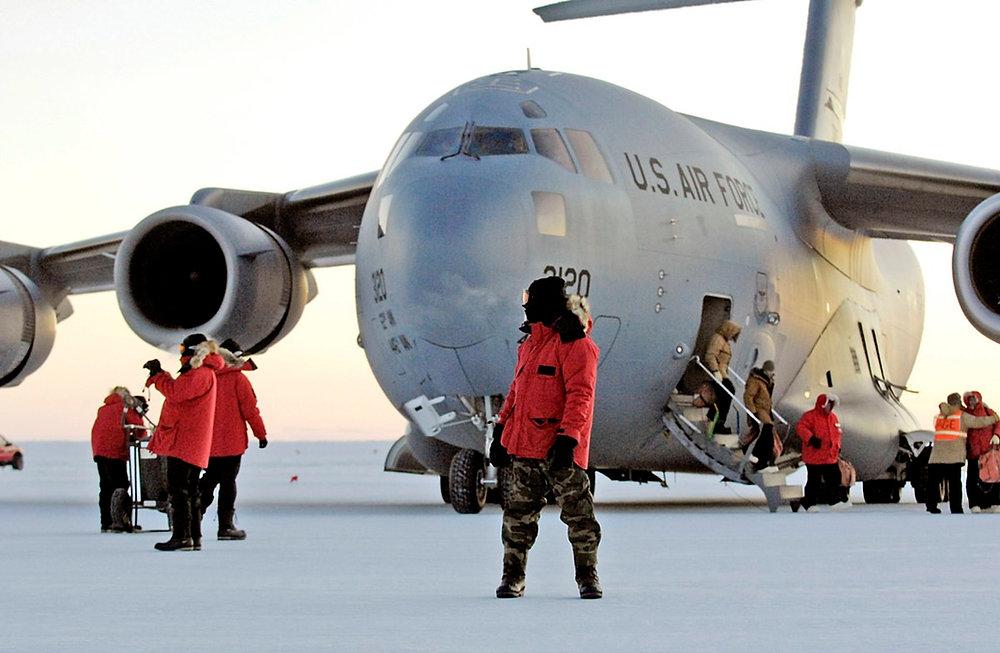
Operation Deep Freeze (USA, 1955-60)
This program was developed by the US to support scientific research, but also served to maintain a presence on the continent for political reasons. Beginning in 1955, Operation Deep Freeze has been the codename for a number of recurring missions over this time. These operations ran for five years straight from 1955 to 1960, but since the introduction of the Antarctic Treaty (in 1959) have morphed into sporadic resupply missions to research bases, since they are restricted to non-military vessels and purposes.
McMurdo Station, located on Ross Island, was built during Deep Freeze I and II, and today continues to be one of the largest Antarctic stations. In the summer, up to over 1000 people populate the station. Deep Freeze III saw the construction of America's Amundsen-Scott Station at the geographic South Pole in 1957-58. The fourth mission introduced Icebreakers and aircraft more equipped for a permanent presence in the South pole (airplanes on skies).
'German Fat Plan' Expedition (Germany, 1938-39)
While Germany had already completed two other expeditions in the 20th century (1901-03 & 1911-12), those were mainly focused on exploration and research. The reason the 1938 expedition stands out as a military operation, is because of it's intent to prepare Germany for WWII.
Leading up to WWII, Hitler attempted to get Germany ready for the upcoming conflict over his four-year plan for 1940. Part of this plan included how to keep Germany fed in the midst of a possible war, and was called the "German Fat Plan". While it may seem laughable, this ambitious plan was based on the fact that Germans, at the time, consumed a lot of margarine, as well as other food and goods in which whale oil was a prime ingredient.
Because Germany relied so much on whale oil, the goal was to gain an independent, direct source so that they would not need to continue relying on Norway and the UK for supply.
To accomplish this, they invested 3 months in resuscitating an old ship into an icebreaker, then set out on an expedition on December 17, 1938 aboard the MS Schwabenland. They landed in what is now known as Queen Maud Land with the goal of scouting locations for a whaling base. The two expeditions that were planned to follow (for actual construction of the base) were cancelled due to the outbreak of WWII in 1939. During their time there, they did take the chance to conduct reconnaissance flights in order to map and claim territory, however did not have enough fuel, and ended up throwing boxes of aluminum swastika flags (intended to mark Nazi territory) out of the aircraft to lose weight. These have never been retrieved, and are still lost somewhere in the expansive, icy plateau of Queen Maud Land.
Modern Military Engagements and Research
To this day, the Antarctic Treaty continues to enforce that no military activity can be conducted on the continent. This means that no military bases may be constructed, no military weapons may be tested (conventional or nuclear), and no military vessels may be deployed there. The only allowed military presence allowed is for 'logistical functions', which includes ensuring the safe travel of personnel and equipment for peaceful purposes. This demilitarization has added to the continuing success of the Antarctic Treaty, with the drive for countries to impose a military presence being negated by it's stipulation that land claims would not be recognized or tolerated anyway.
Sources
Bluoin, Buddy. “Is There an Antarctica Military Base?” Mybaseguide.com, My Base Guide, mybaseguide.com/antarctica-military-base.
Brady, Hillary. “Explore the Arctic with Operation Windmill.” Smithsonian Institution Archives, The Smithsonian Institution, 28 Jan. 2016, siarchives.si.edu/blog/explore-arctic-operation-windmill.
Cool Antarctica. “Nazi Antarctic Base.” Www.coolantarctica.com, Cool Antarctica, www.coolantarctica.com/Community/antarctic-mysteries-hitlers-secret-base.php#google_vignette.
Garmont Tactical. “Operation Deep Freeze: The US Missions to Antarctica.” Garmont Tactical, Garmont Tactical USA, 2022, garmonttactical.com/post/operation-deep-freeze-the-us-missions-to-antarctica.html?srsltid=AfmBOoqFeq131RFBzLTYzo8u6PwSECtQX5GUL8L3TwmzdlDs5TRRc9nd.
Groff, Bethany. “Analysis: Inter-American Treaty of Reciprocal Assistance | EBSCO.” Www.ebsco.com, EBSCO Information Services, Inc., 2021, www.ebsco.com/research-starters/diplomacy-and-international-relations/analysis-inter-american-treaty-reciprocal.
Imperial War Museum. “A Short History of the Falklands Conflict.” Imperial War Museums, Imperial War Museums, 2024, www.iwm.org.uk/history/a-short-history-of-the-falklands-conflict.
Lawrence Livermore National Laboratory. “Operation Argus.” St.llnl.gov, Lawrence Livermore National Security, LLC for the Department of Energy’s National Nuclear Security Administration, st.llnl.gov/news/look-back/operation-argus.
Micallef, Joseph. “Military History of Antarctica.” RealClearHistory, RealClearHistory, 12 Jan. 2023, www.realclearhistory.com/articles/2023/01/11/military_history_of_antarctica_874524.html.
Niiler, Eric. “Hitler’s Secret Expedition to Antarctica | HISTORY.” History.com, A&E Television Networks, LLC, 27 July 2018, www.history.com/articles/hitler-nazi-secret-expedition-antarctica-whale-oil.
Oceanwide Expeditions. “Operation Tabarin: The Top Secret Mission That Helped to Preserve Antarctica.” Oceanwide-Expeditions.com, Oceanwide Expeditions, 2024, oceanwide-expeditions.com/blog/operation-tabarin-the-top-secret-mission-that-helped-to-preserve-antarctica.
Ommanney, Francis D. “Richard E. Byrd | American Polar Explorer & Aviator.” Encyclopedia Britannica, Encyclopedia Britannica, 20 July 1998, www.britannica.com/biography/Richard-E-Byrd#ref524689.
Teuscher, Carson. “The Cold, Cold War: Rear Admiral Richard Byrd, Antarctic Expeditions, and the Evolution of America’s Strategic Interest in the Polar Regions.” The Arctic Institute, The Arctic Institute , 2 Nov. 2021, www.thearcticinstitute.org/cold-cold-war-rear-admiral-richard-byrd-antarctic-expeditions-evolution-americas-strategic-interest-polar-regions/.